
Marine AIS GPS Navigator High Precision With Chart Plotter Built-in high sensitivity GPS receiver board with accurate positioning, adopting advanced and independent R&D technology of high stable navigational speed and course.
Marine AIS GPS High Precision Navigator Features :
- Stable quality for AIS seires;
- Support GPS + Beidou Accurate positioning.
- Enavi adopts S52 standard chart display, supports…
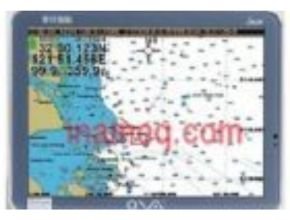
Product Details
- Built-in high sensitivity GPS receiver board with accurate positioning, adopting advanced and independent R&D technology of high stable navigational speed and course.
- Stable quality for AIS seires
- Support GPS + Beidou Accurate positioning
- Enavi adopts S52 standard chart display, supports international S57 and S63 chart format
- Long reception distance and strong receiving sensitivity
- A large number of receiving vessels
- Built-in free map
- Excellent anti-interference processing.
- High Precision Marine AIS GPS Navigator With Chart Plotter
Techinal Parameters
| Power Supply | DC 24V(11-35V) |
| Power | High-performance,full isolated, PWM control of powersupply |
| Installation | Bracket or Embedded |
| Power Consumption | <20W |
| Language | Simplfied Chinese,TraditionalChinese,English |
| Navigation Characteristics | |
| Data Storage | Plotting point: 10000 Plotting line: 10000 Plotting surface: 10000 Waypoints: 100000 Routes: 10000(500 waypoints/route) Tracks<10000(points<50000) |
| Data Display | Suspension data :Information of ship’s latude andlongude,fish zone,speed, course:Navigation information |
| Other Function | Tideand CompassInterface;AIS Display and Alarm,AJS Message, VesselManagement(lf input AIS) |
| GNSS Characteristics | |
| Receive Type | Gps/Glonass/Gafileo/Beidou Support: WAAS/EGNOS/MSAS/GAGAN |
| Acquisition Time | Cold start: 45s, Hot start: 15s |
| Accuracy | Gps<1Sm (95%) Beidou:Horizontal25m (95%) Vertical30m (95%) |
| Interface | |
| lnput/Output | GPS/Beidou (GGA, GLL,GSA,RMC,VTG,AIS(VDM)) |
| SD Card | Update software andchart, import and export data |
| AIS Performance | |
| Frequency | AIS 1: 87B/161.975MHz AIS 2: 88B/162.025MHz |
| Bandwidth | 25KHz |
| Output Power | 2W |
| Modulation | GMSK |
System Connection
High Precision Marine AIS GPS Navigator With Chart Plotter System connection
other Article:
- Four LED EX Explosion proof Lamps for the Fire Department
- Bacharach PCA® 400 Active Sample Conditioner
- PCA® 400 Combustion & Emissions Analyzer Bacharach
- Combustion Efficiency Analyzer ECA 450 Bacharach
- Bacharach MGS-550 Industrial Gas Detector