
Overview
Aquaread GPS Leveline Meter is designed to be used with all Leveline Water Level and Temperature loggers. The meter has many uses including LeveLine setup, data download, and the novel GPS embedding feature which tags the LeveLines deployment location into the dataset
Aquaread GPS Leveline Meter Features
Easy to use interface
- Full LeveLine setup directly from the GPS LeveLine Meter
- Initiate Scheduled logging meaning there is no need to set a planned start date
- Embed the LeveLine with its GPS deployment coordinates
- Download data from multiple LeveLines deployed in the field
- Perform live spot testing
- Check LeveLines battery and memory levels prior to deployment
- Manually input the level for salinity compensation
- Built in air pressure sensor for atmospheric pressure measurement
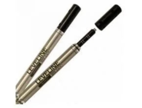
- Ergonomic curved design sits nice in the hand, with rubber gasket for added grip in wet condition
- Rugged, metal AquaConn connectors provide extreme durability where its needed most
- LeveLine PC application and USB cable provided with every PC-KIT purchased for use with the LeveLine
Applications
- Groundwater level monitoring, pump tests, slug tests etc.
- Stream, lake and reservoir water level measurement.
- Wetland and flood water monitoring.
- Coastal monitoring.
- Tank level measurement.
- Long term continuous monitoring in boreholes, surface water and seawater applications.
MAKE YOUR LIFE EASIER IN THE FIELD
Some of the GPS LeveLine Meters features can really assist your logger deployment and your logger collection when the scheduled logging is complete. The meter allows you to make adjustments to your LeveLine in the field. For example you can increase the logging duration or increase the logging frequency. In fact you can perform all of the set up actions that you can on the LeveLink PC application.
When you are on site and ready to deploy your LeveLine you can use the GPS LeveLine Meter to check the LeveLine’s battery and memory levels, you can also zero the depth measurement against the current reading of air pressure measured by the meter.
EMBED THE LEVELINE WITH ITS GPS DEPLOYMENT COORDINATES
The most novel feature of the GPS LeveLine meter is the ability to embed the GPS deployment coordinates into the LeveLine. This means that when you collect your loggers and take them back to the office, each logger knows exactly where it was deployed. The information is contained within the logger and can be displayed in Google Earth.
Aquaread GPS Leveline Meter Specifications
| LEVELINE (Abs & Gauge) | LEVELINE – BARO | ||
| General | Temperature ranges (non freezing) | Operational: -20-80° C (-4-176° F) | Operational: -20-80° C (-4-176° F) |
| Storage: -40-80° C (-40-176° F) | Storage: -40-80° C (-40-176° F) | ||
| Compensated: -20-80° C (-4-176° F) | Compensated: -20-80° C (-4-176° F) | ||
| Diameter | 22mm (0.866 in) | 22mm (0.866 in) | |
| Length | 186mm (7.32 in) | 186mm (7.32 in) | |
| Weight | 150g (5.3oz) | 160g (5.6oz) | |
| Materials | Titanium body, Delrin nose cone | Titanium body, Delrin nose cone | |
| Output options | Modbus/RS485, SDI-12, Aquaread proprietary | Modbus/RS485, SDI-12, Aquaread proprietary | |
| Battery type & life | 3.6V lithium; up to 10 years (see note 1) | 3.6V lithium; up to 10 years (see note 1) | |
| External power | 6 – 24 VDC | 6 – 24 VDC | |
| Memory | Size | 8.0 MB | 2.0 MB |
| Data Records | 500 | 150 | |
| Log types | Linear, Event & User-Selectable Schedule with Future Start, Future Stop, Deploy Start and Real Time View | Linear, Event & User-Selectable Schedule with Future Start, Future Stop, Deploy Start and Real Time View | |
| Fastest logging rate & Modbus rate | 10 per second | 1 per minute (logging) 5 per second (Modbus) | |
| Fastest SDI-12 | 1 per second | 1 per second | |
| output rate | |||
| Accurate to 1 second/24-hr period | Accurate to 1 second/24-hr period (± 6 minutes/year) | ||
| Real-time clock | (± 6 minutes/year) | ||
| Pressure Sensor | Type / Material | Piezoresistive; ceramic | Piezoresistive; ceramic |
| 10.0m (32.8 ft) 20.0m (65.6 ft) | |||
| Range (Absolute) | 50.0m (164 ft), 100m (326 ft) | 0 to 16.7 psi; 0 to 1.15 bar | |
| Range (Gauge) | 10.0m (32.8 ft) 20.0m (65.6 ft) | N/A | |
| 50.0m (164 ft), 100m (326 ft) | |||
| Maximum pressure | Max 2x range, Burst 2.5x range | Max 2x range, Burst 2.5x range | |
| Accuracy @ 15° C | ±0.05% FS | ±0.1% FS | |
| (see note 2) | |||
| Accuracy (FS) | ±0.1% FS | ±0.2% FS | |
| ( see note 3) | |||
| Resolution | 0.002% FS or 1mm whichever is greater | 0.1mb | |
| Units of measure | Pressure: mbar (psi, kPa, bar, mmHg, inHg, cmH2O, inH2O, Level: in, ft, mm, cm and m available in LeveLink) | Pressure: mbar (psi, kPa, bar, mbar, mmHg, inHg, cmH2O and inH2O available in LeveLink) | |
| Temperature Sensor | Accuracy Resolution | ±0.1° C | ±0.1° C |
| 0.01° C | 0.01° C | ||
| Output Units | Celsius (fahrenheit available in LeveLink) | Celsius (fahrenheit available in LeveLink) | |
| endent on logging rate. 2) Across factory-calibrated pressure range at a constant temperature. 3) Across factory-calibrated pressure and temperatu | |||
Download Datasheet: Aquaread GPS Leveline Meter
Other Article:
- APG Continuous Float Level Transmitter MPX API 18.2
- APG Intrinsically Safe Flexible Magnetostrictive Float Level Transmitter MPI-F
- AGP True Echo Pulse Radar Level Transmitter For Liquids PRL
- AGP Ultrasonic Level Sensors
- AGP Intrinsically Safe Ultrasonic Level Transmitter LPU-2428
- Delta Mobrey 246781ZA High Pressure Electrode
- APG IRU-9400 High Sensitivity 35 Ft Ultrasonic Level Sensor
- Magnetostrictive Level Transmitter TC Fluid Controls
- Quality Gauge & Level Series Q175 and Q170 Tubular
- APG Radar Level Transmitter PRX True Echo Explosion Proof Pulse